PCT 2025 Oregon Section D / Diamond Wilderness - Day 41
08.08.2025
Wow, das war ein Start in den Tag.
Das Feuer brannte noch immer am Highway, und die Straße Richtung Willamette Pass blieb gesperrt.
Ich stand mit Anna in Kontakt. Sie konnte nicht zur Arbeit fahren, meinte aber, dass man die Situation weiter beobachte und auch spontan reagieren könne.
Anna bot mir an, noch eine weitere Nacht in dem Haus zu bleiben – kostenlos. Das war unglaublich großzügig, und ich war unendlich dankbar.
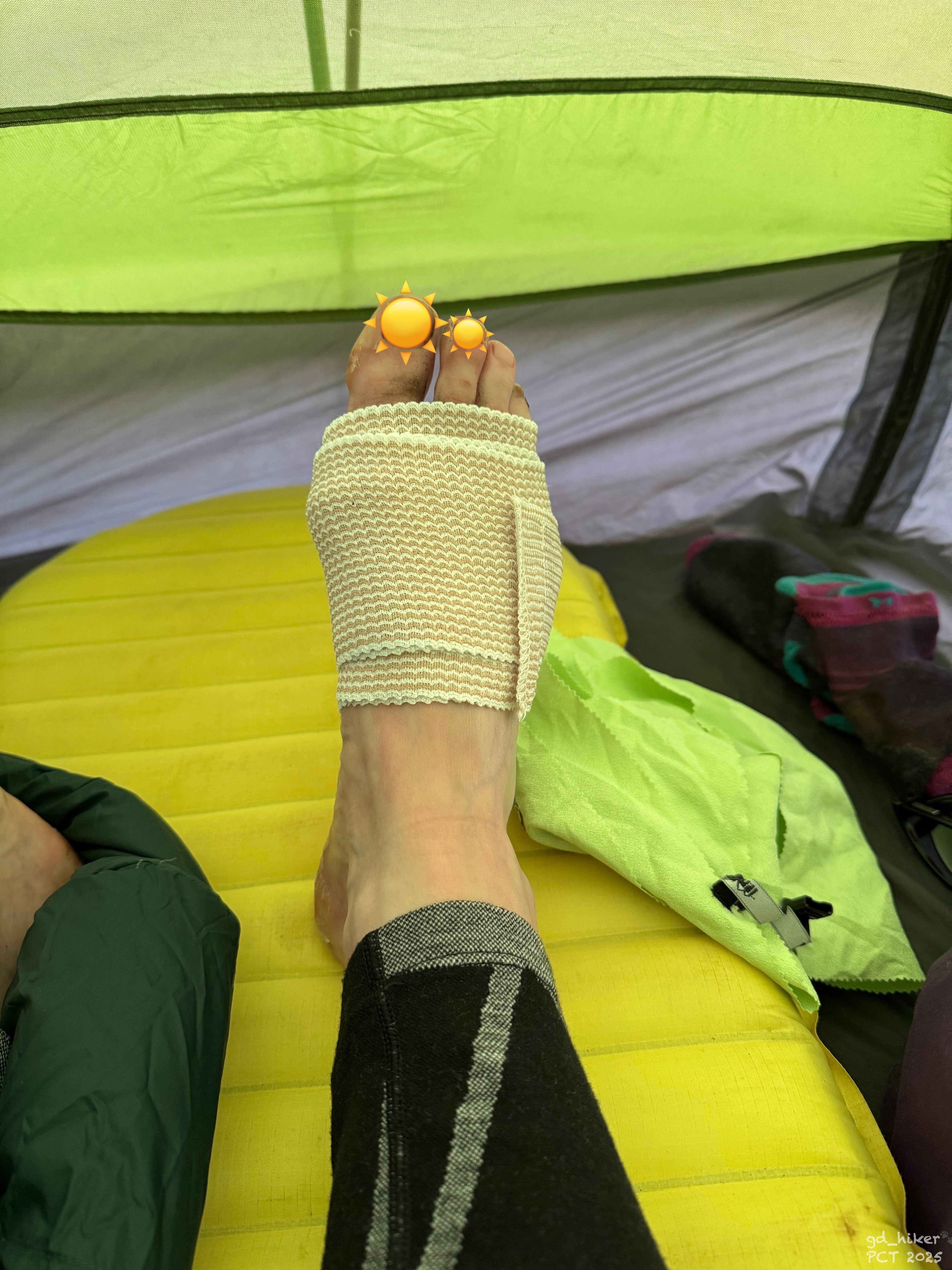
Und trotzdem war ich auch frustriert – sah es aber gleichzeitig als Zeichen, dass ich noch etwas Ruhe brauchte. Meine Füße waren noch nicht ganz verheilt, aber mit Wasserbädern, Salbe und Antibiotika ging es ihnen schon deutlich besser.
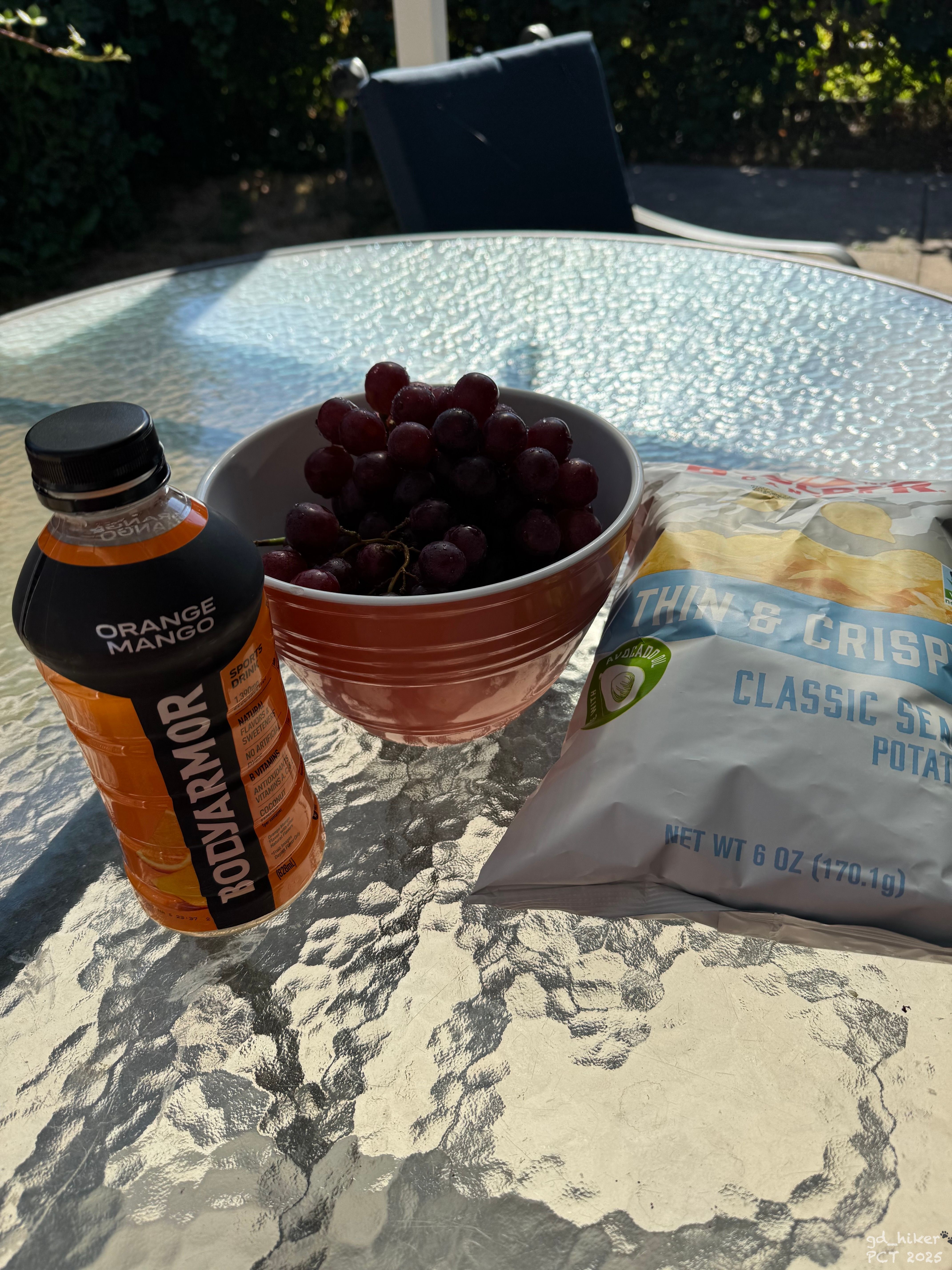
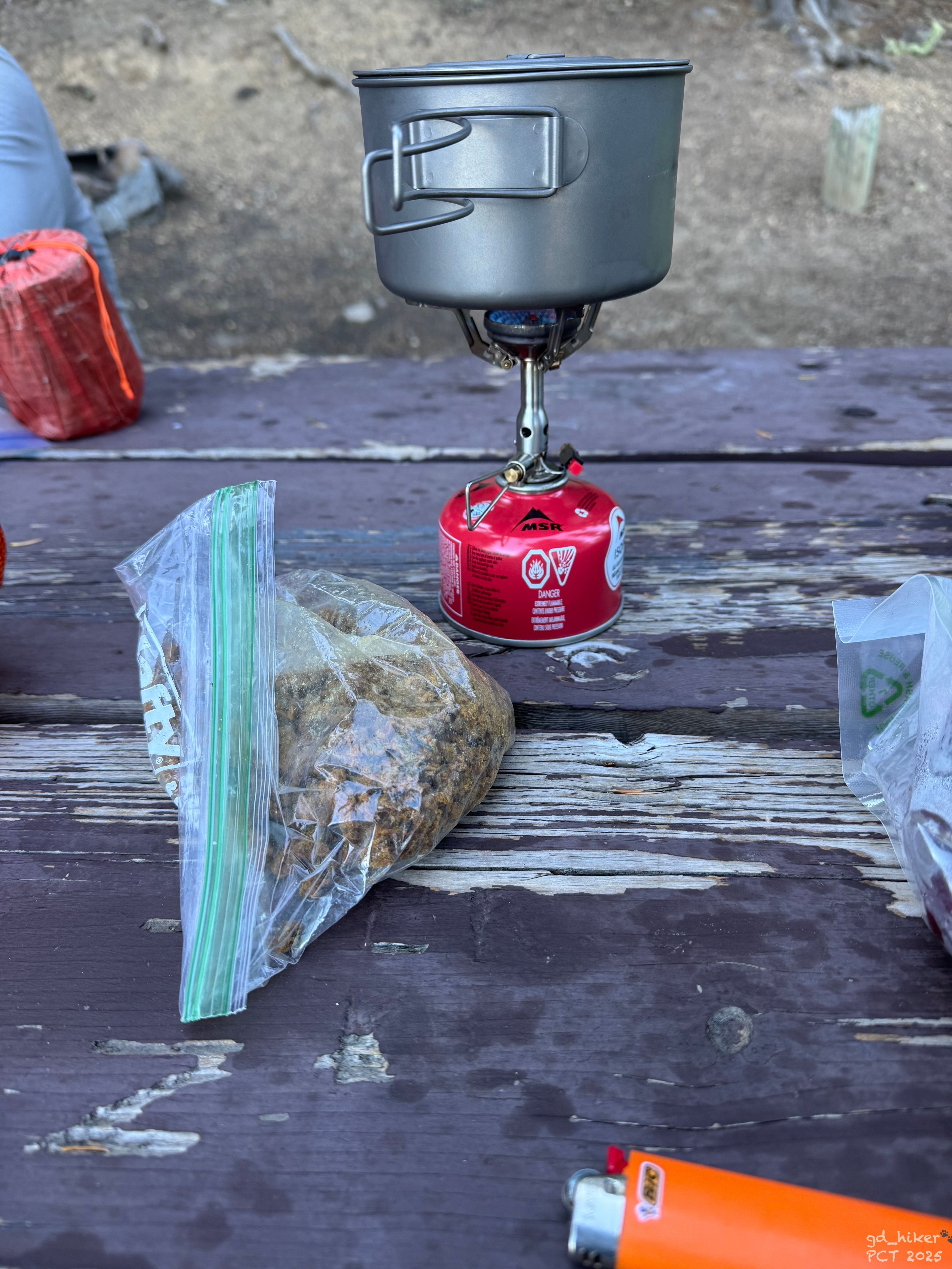
Ich ging also nochmal einkaufen, in dem Wissen, dass ich erst am nächsten Tag weiterkommen würde – da schrieb mir Kevin, ein weiterer Co-Host des Hauses.
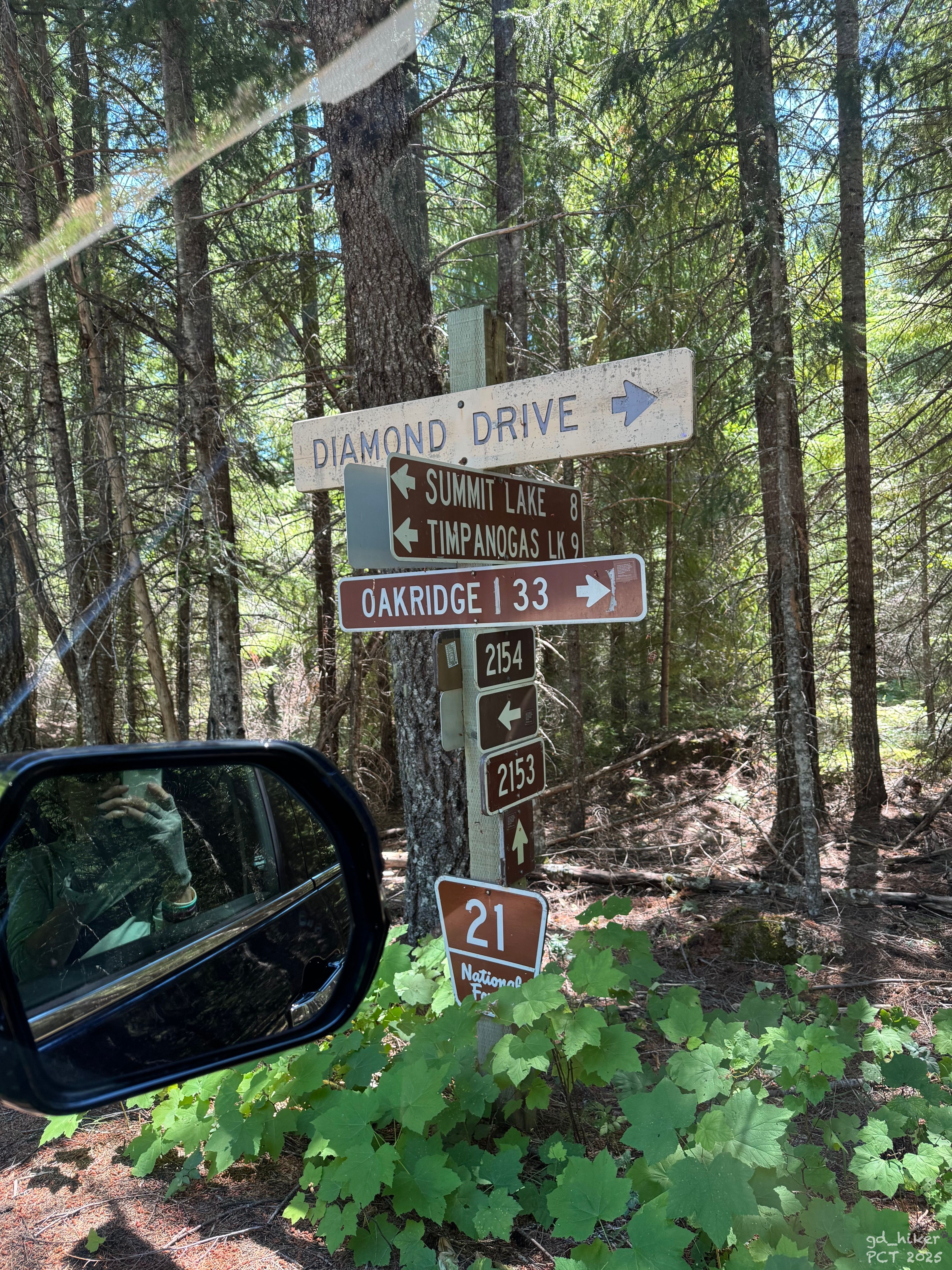
Er wollte zum Summit Lake, der ebenfalls am PCT liegt - etwa 25 km südlich des Willamette Pass. Um 13:00 Uhr würde er mich abholen.
Er meinte, er kenne einen Weg, die Sperrung zu umfahren, und weiter südlich seien die Forest Roads wohl auch nicht gesperrt.
THE TRAIL PROVIDES.
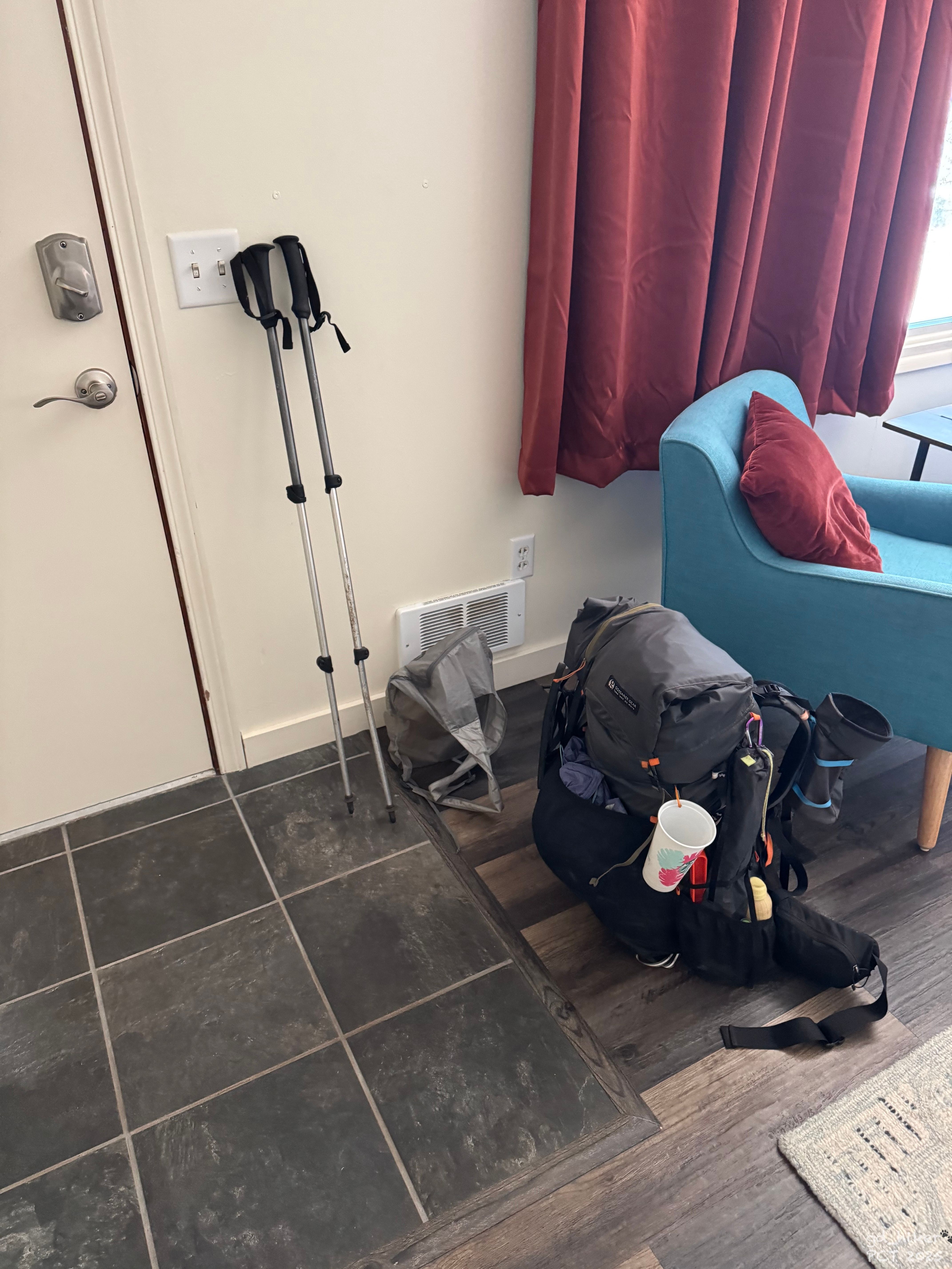
Schneller, als ich denken konnte, stimmte ich zu und packte meinen Rucksack wieder zusammen.
Kevin erschien pünktlich am Haus, und wir machten uns direkt auf den Weg.
Mit dabei war auch sein flauschiger Begleiter – dessen Namen ich leider vergessen hatte.
Kevin erzählte viel von der Gegend, wo er früher gearbeitet und auch gewandert war.
Ich war einfach happy, dass ich an diesem Tag doch noch auf den Trail zurückkommen konnte.
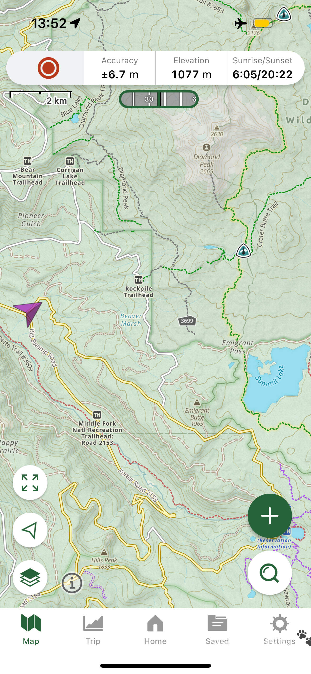
Gegen 14:15 Uhr setzte mich Kevin - aus meiner Sicht zu einem Trail Angel aufgestiegen - am Summit Lake ab. Ich bedankte mich herzlich, und wir verabschiedeten uns.
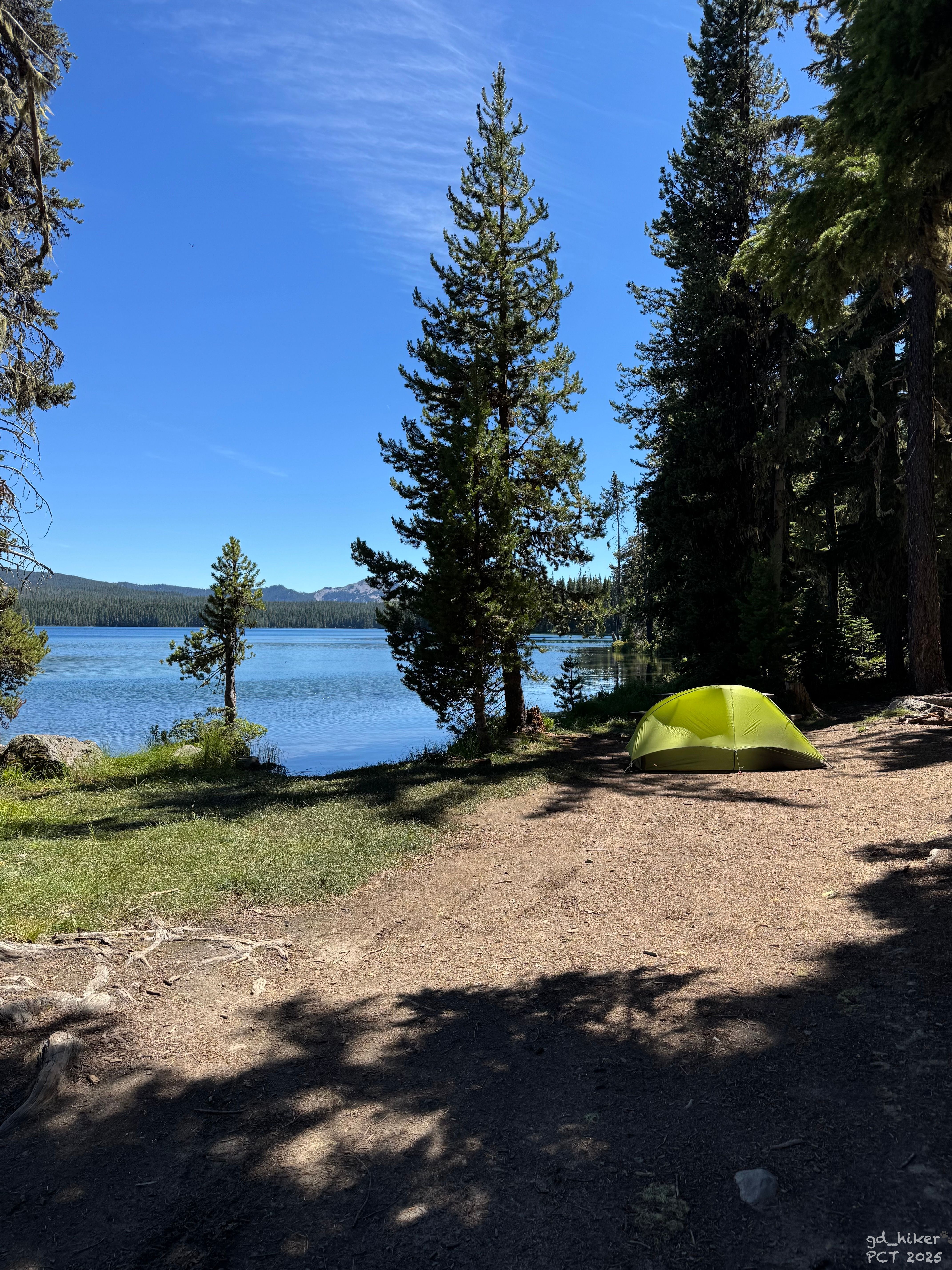
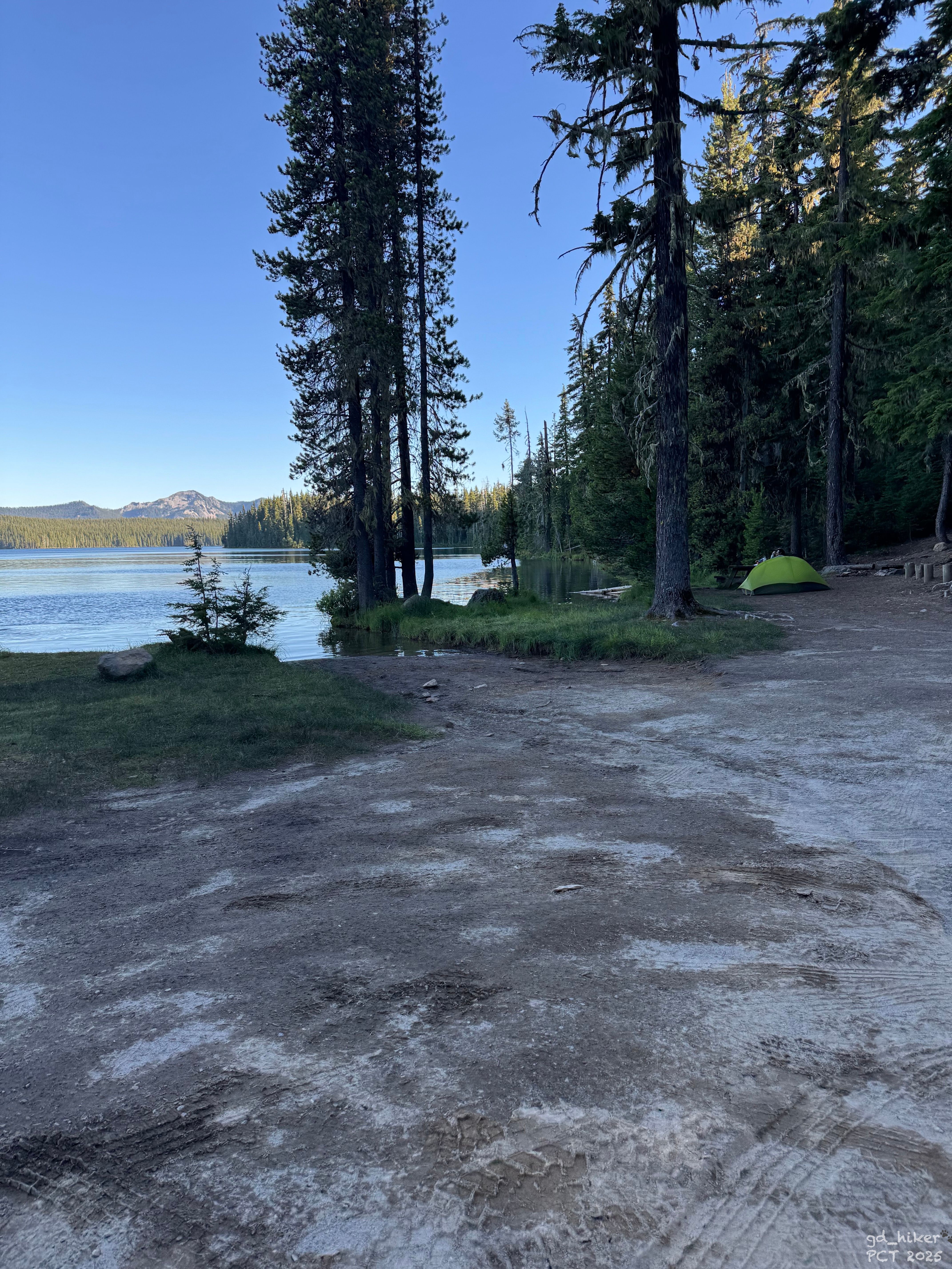
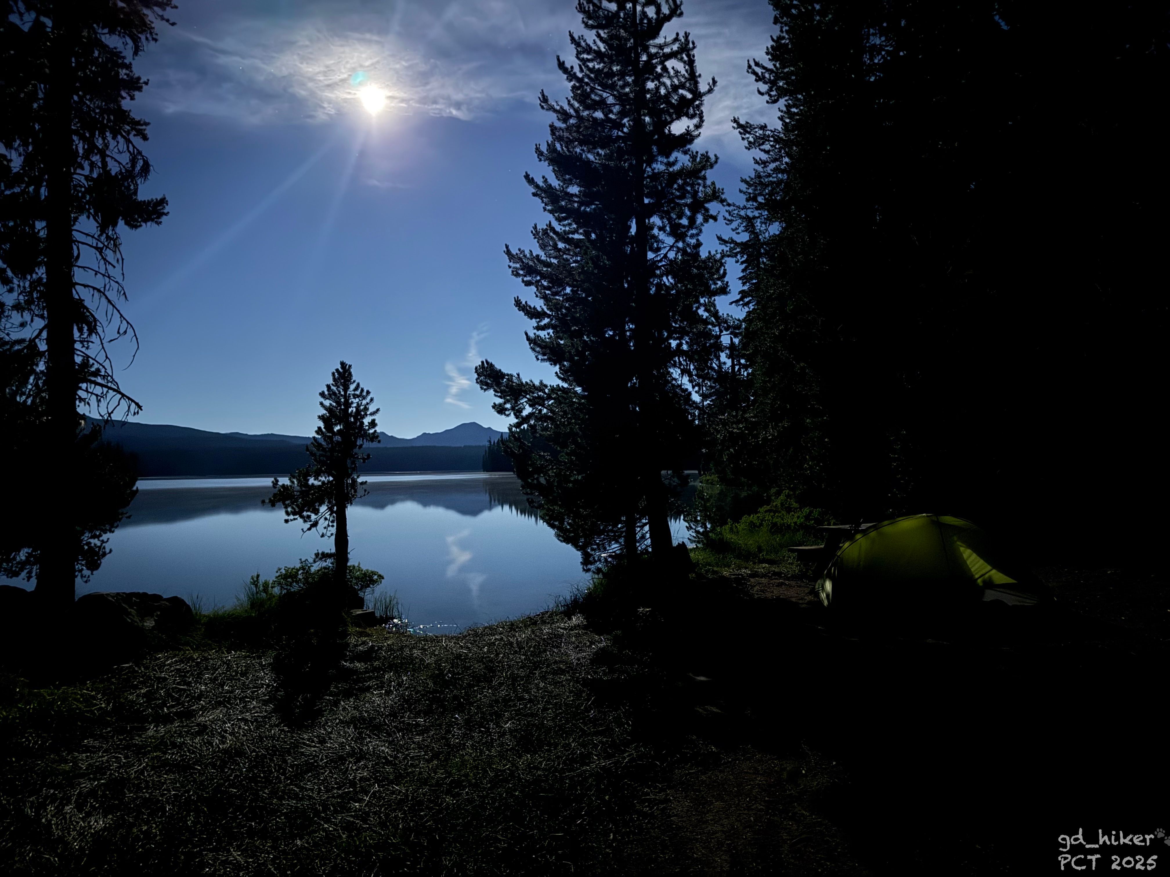
Gesagt, getan – wenig später stand mein Zelt auf einem schönen Platz direkt am Wasser, und ein Tisch sorgte für einen Hauch von Komfort.
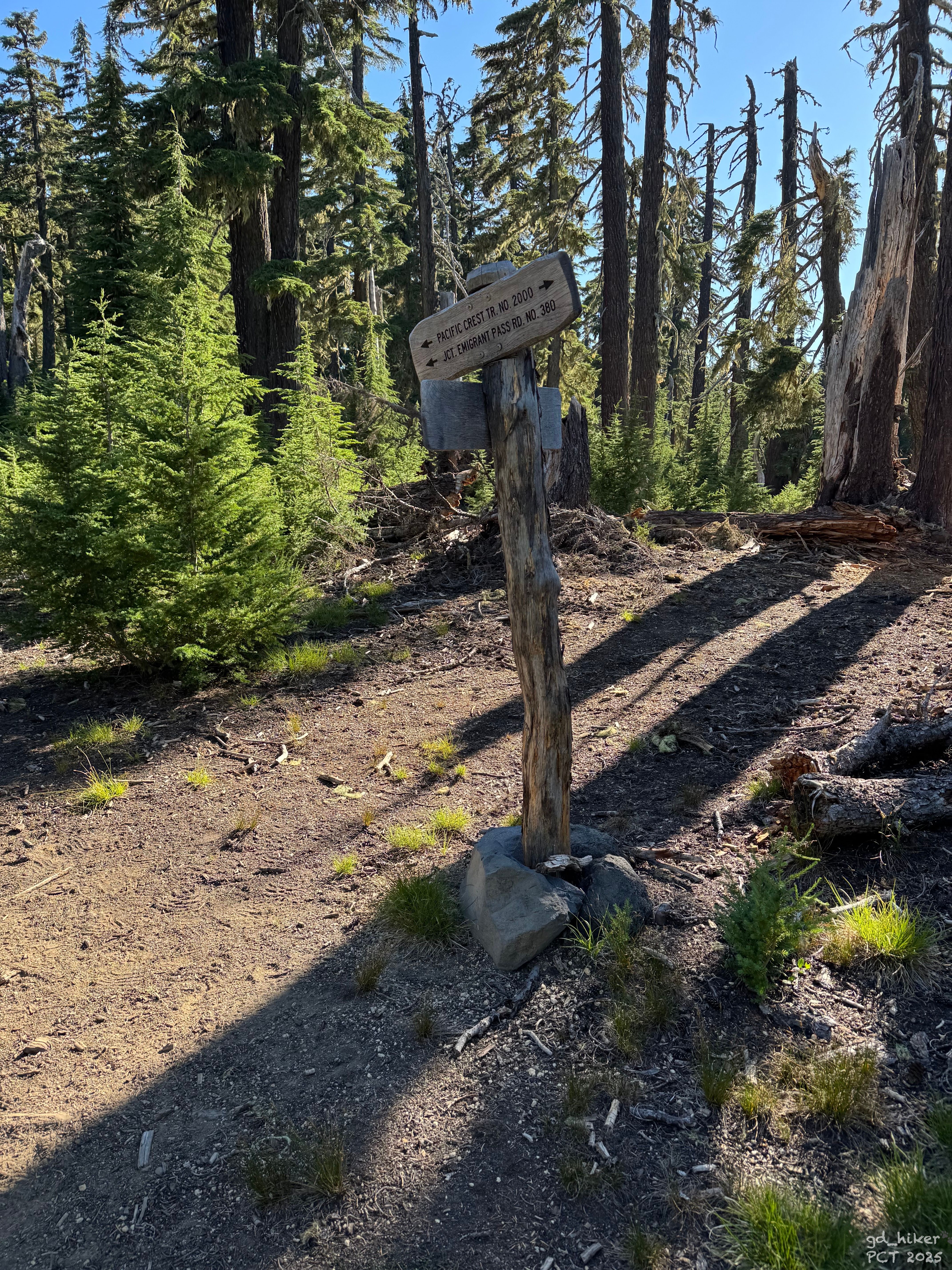
Ich packte Wasser und meinen Apfel in meinen Daypack und suchte den PCT-Trailhead in Richtung Norden.
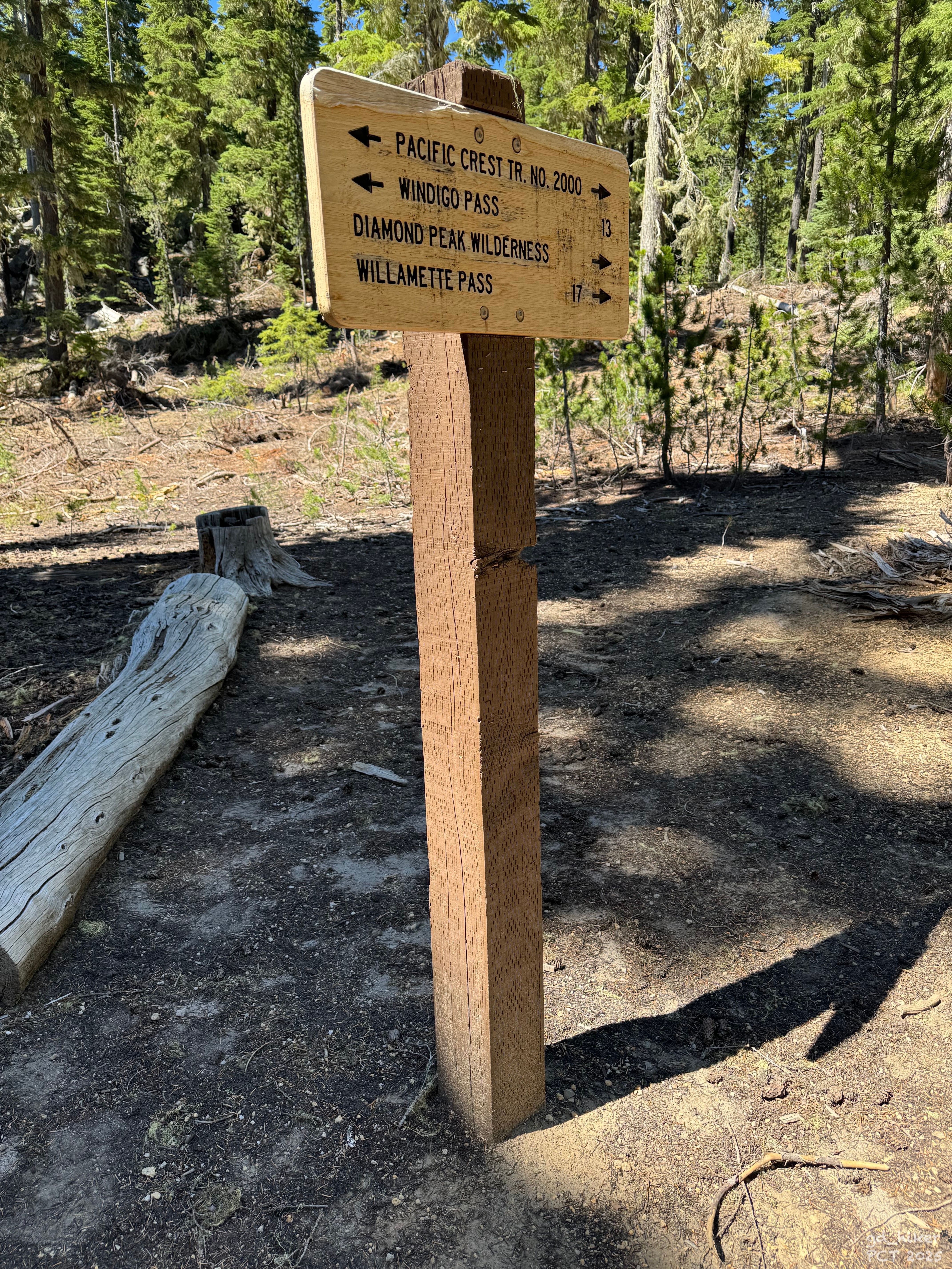
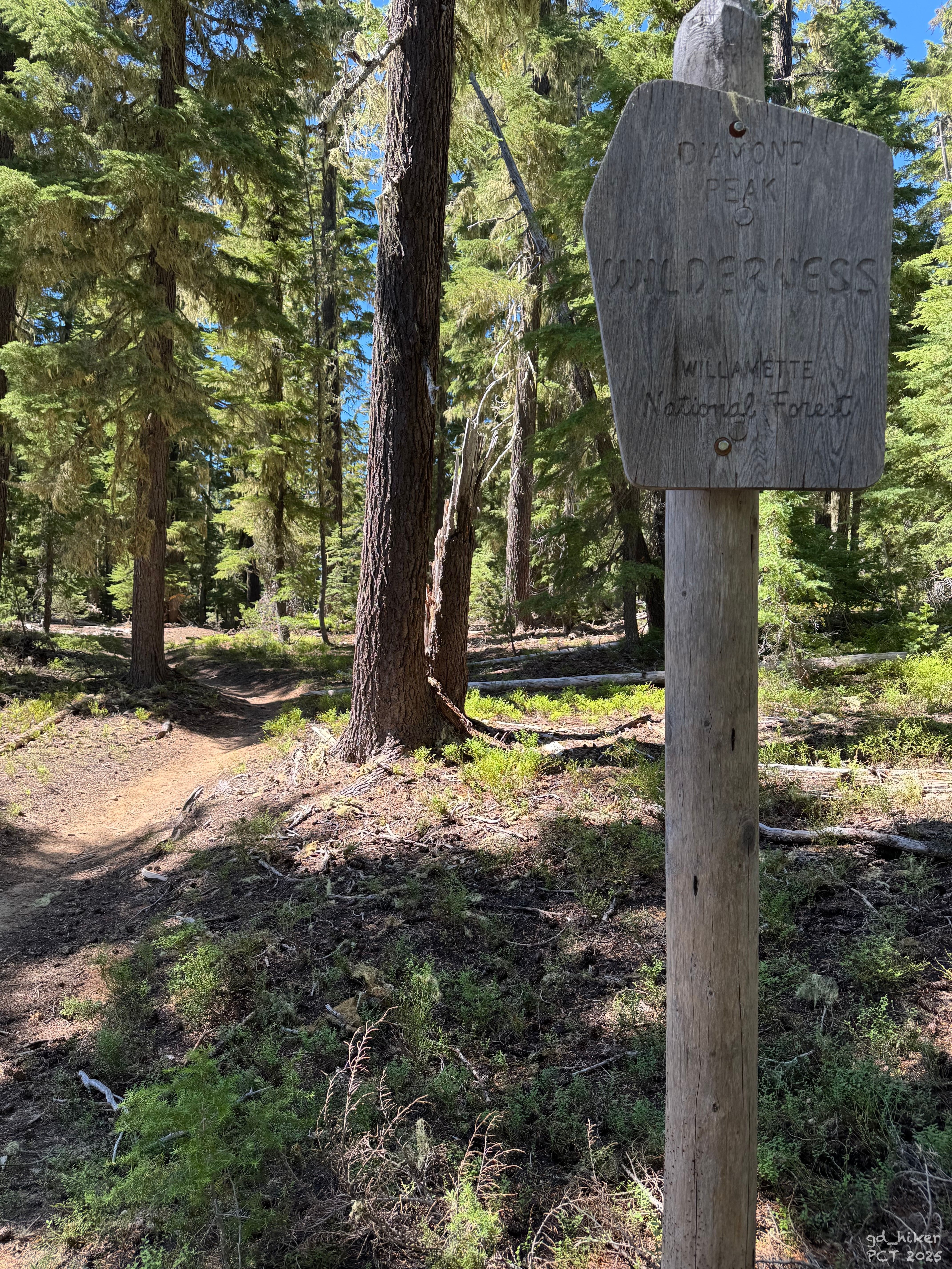
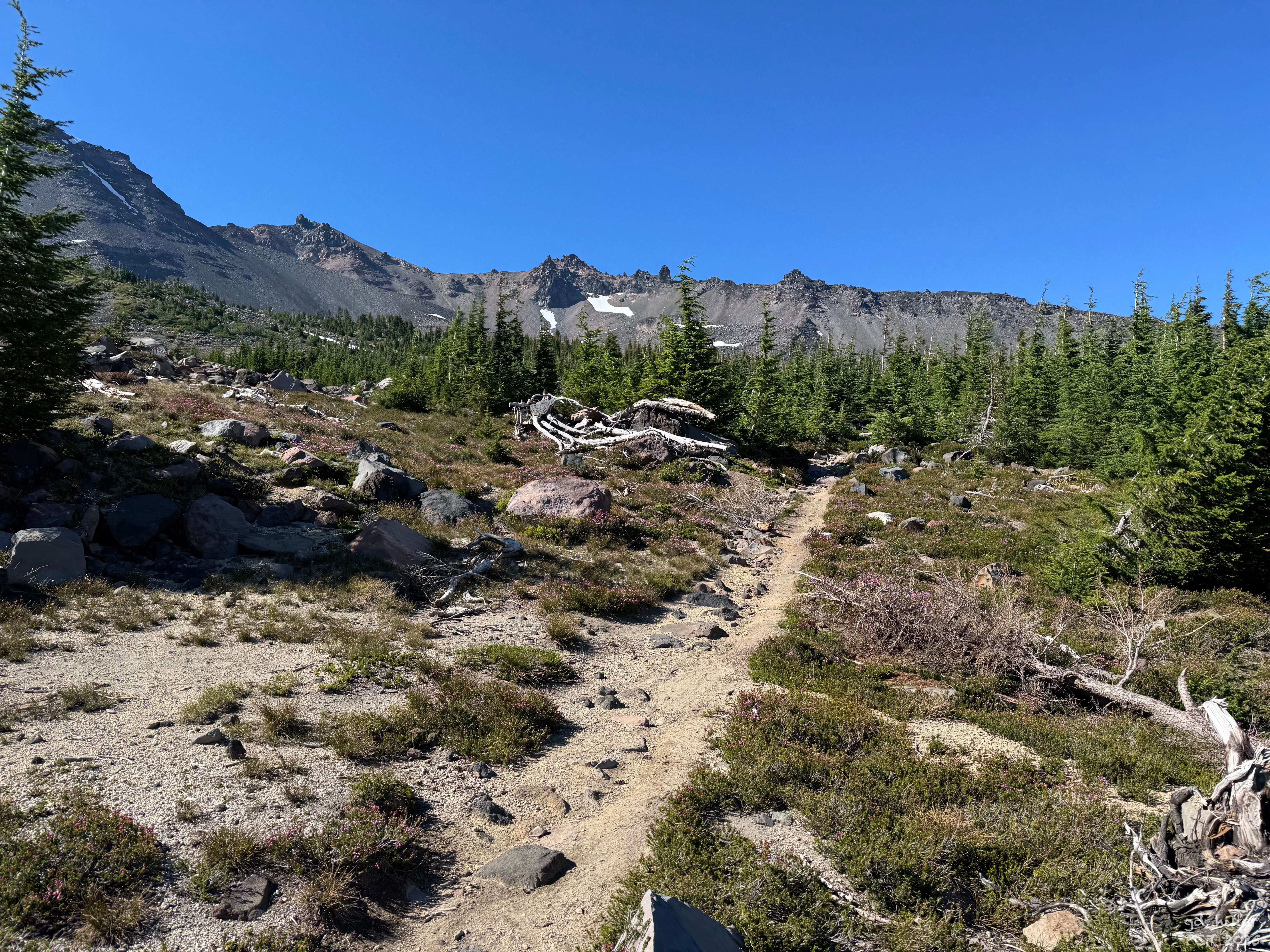
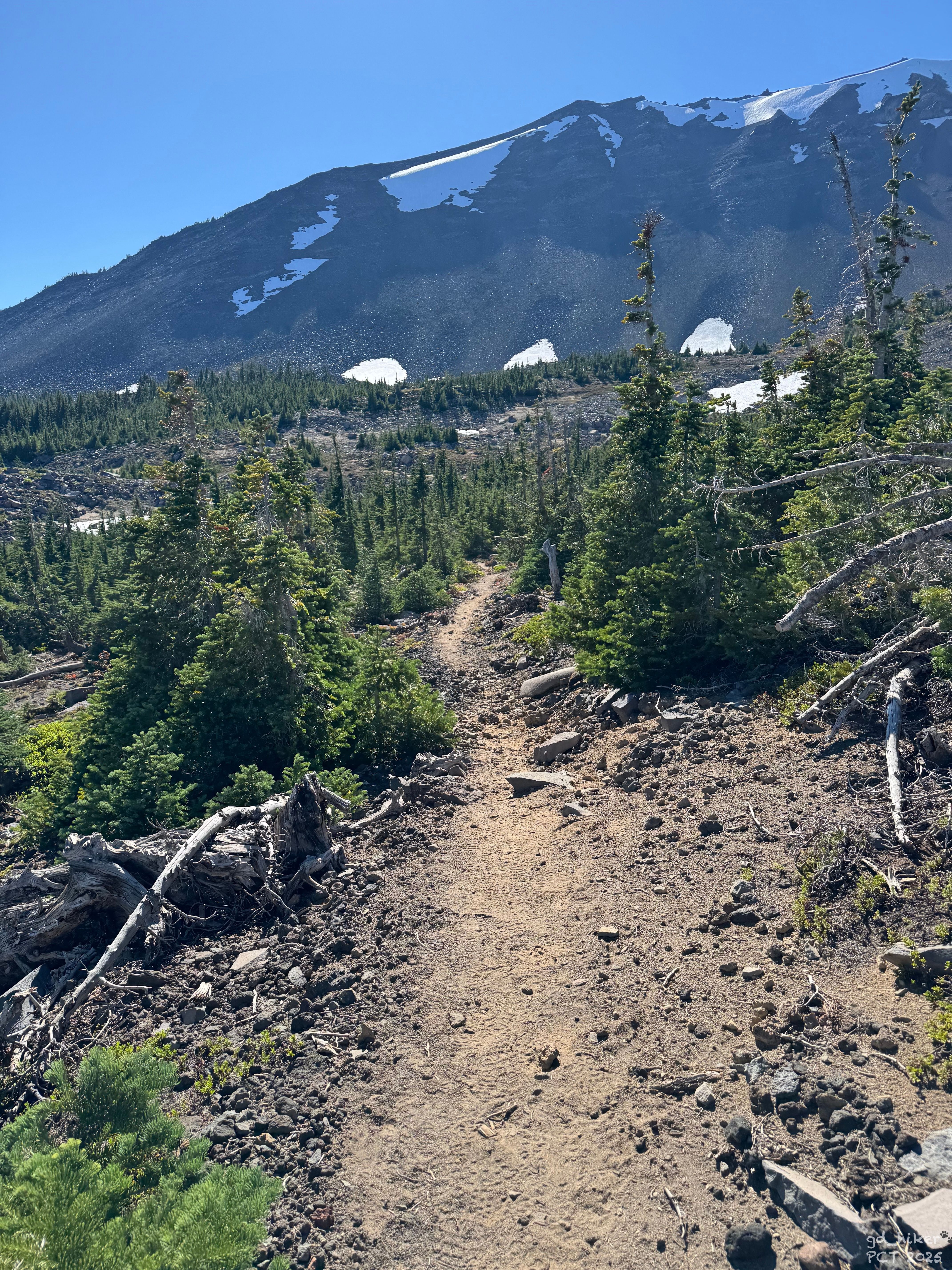
Ich fand den Einstieg, und los ging es. Mit leichtem Gepäck fühlte es sich ungewohnt, aber auch angenehm an, als ich mich auf den Weg hinauf zu einem Aussichtspunkt auf den Diamond Peak machte.
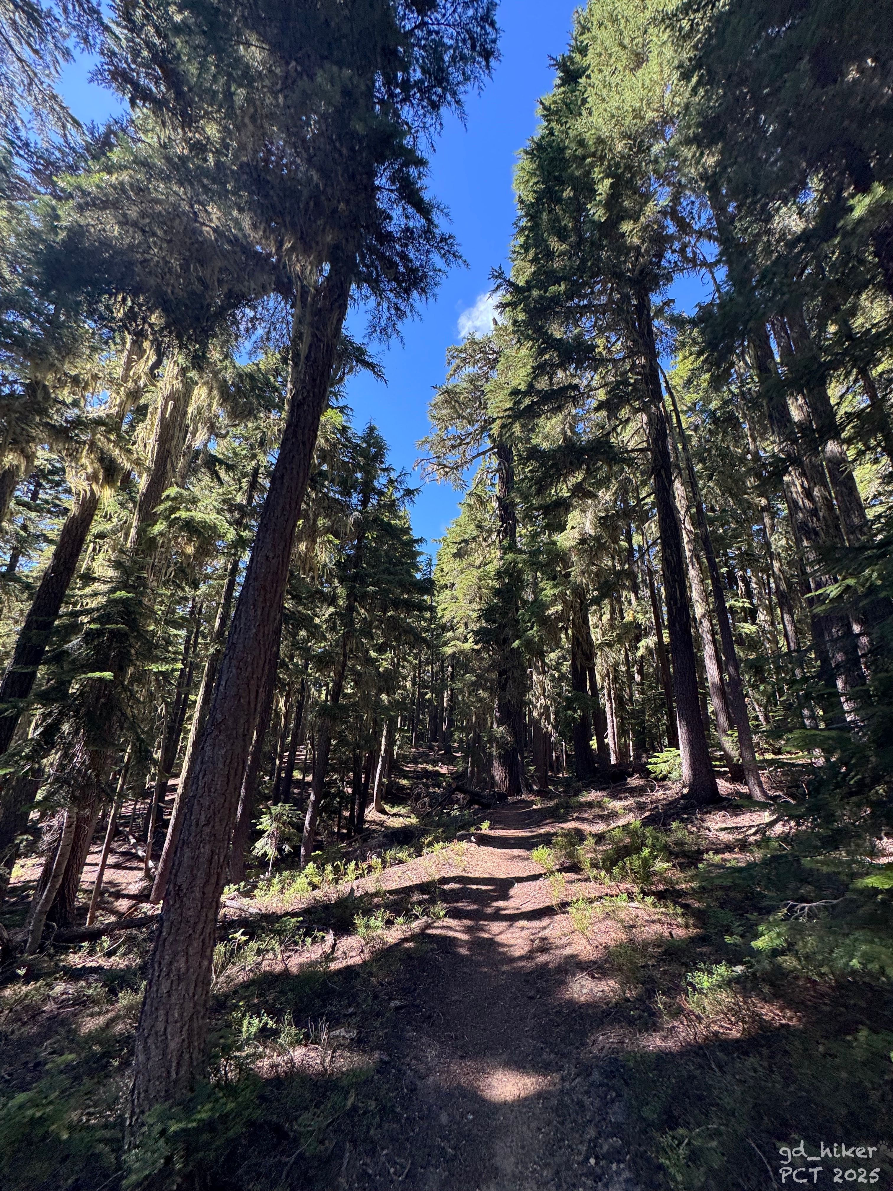
Auf dem sanften Anstieg passierte ich einige Seen - aktiv mit dabei war das Mückenvolk – stehenbleiben sollte man besser vermeiden.
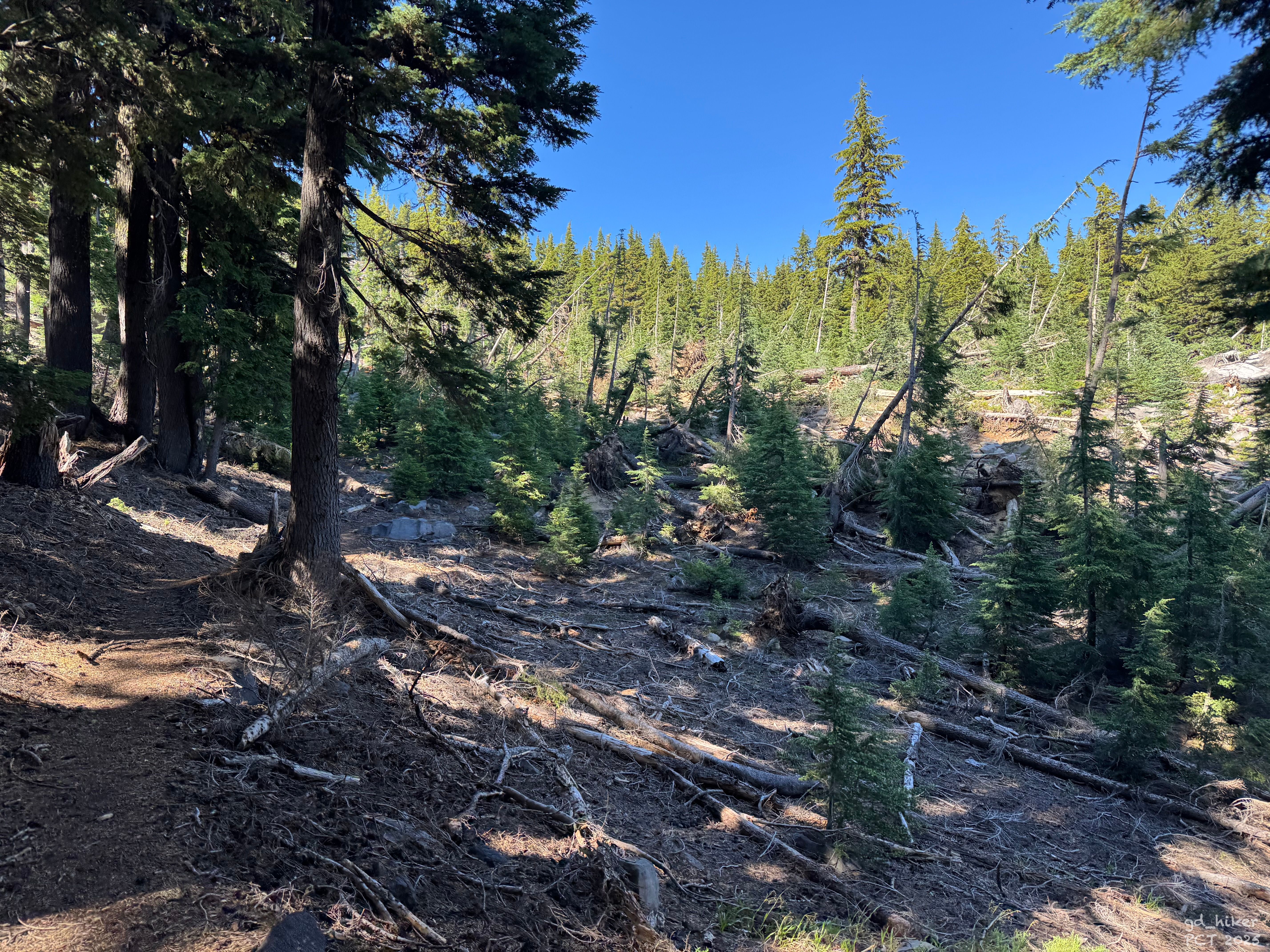
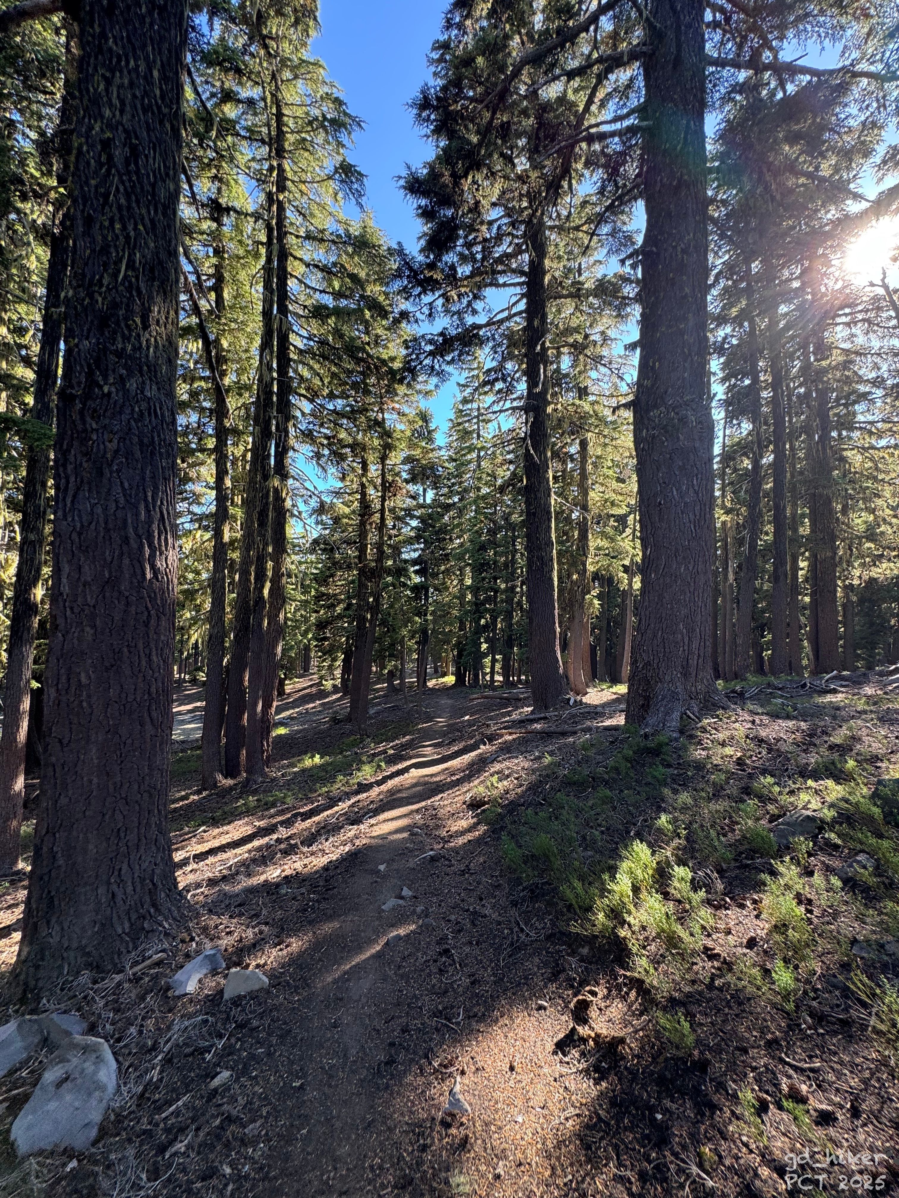
Ich kletterte über ein weiteres wildes Lawinen- und Baumfall-Feld und schmunzelte über das vergleichsweise kurze Section-K-Stück.
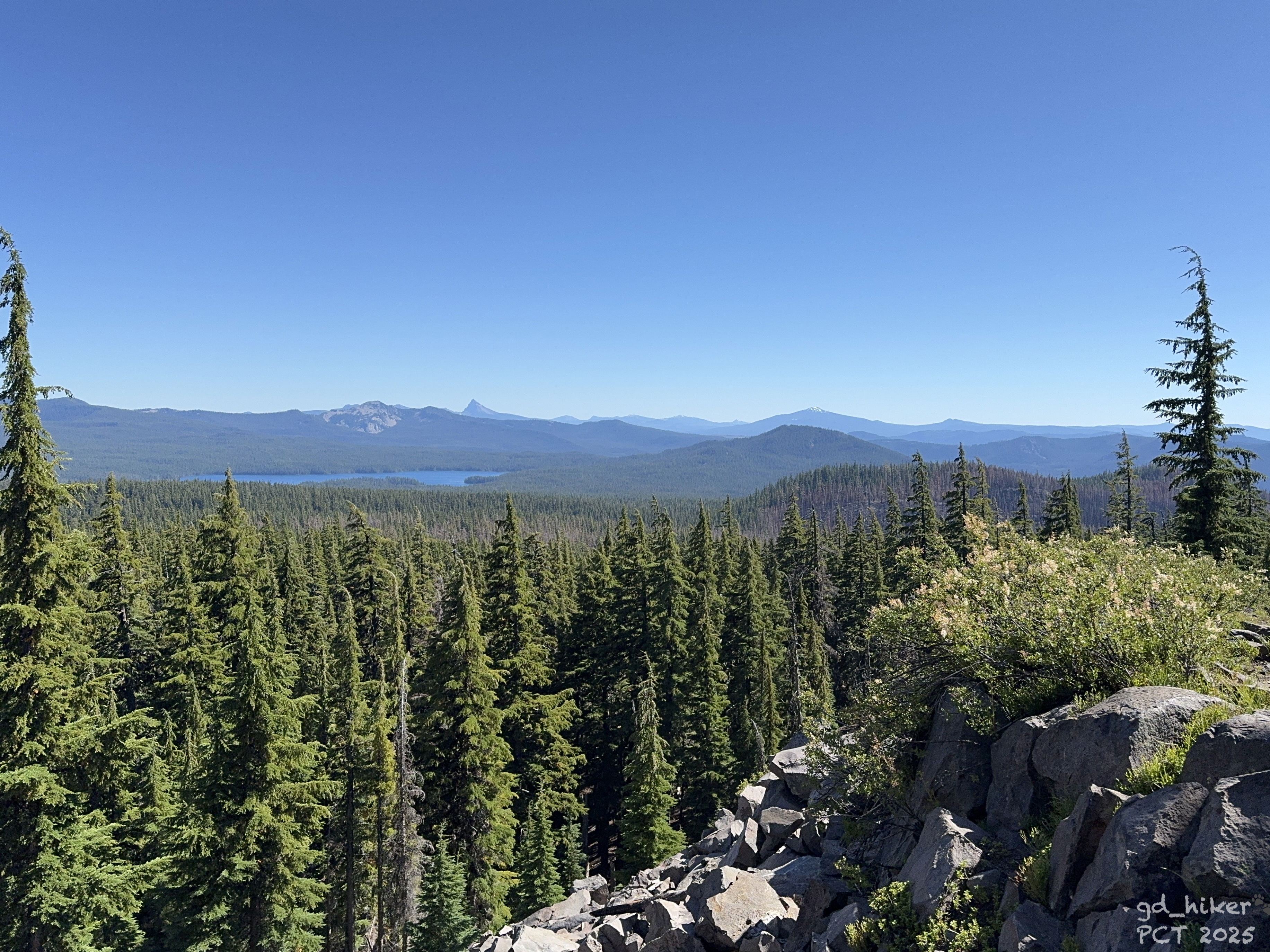
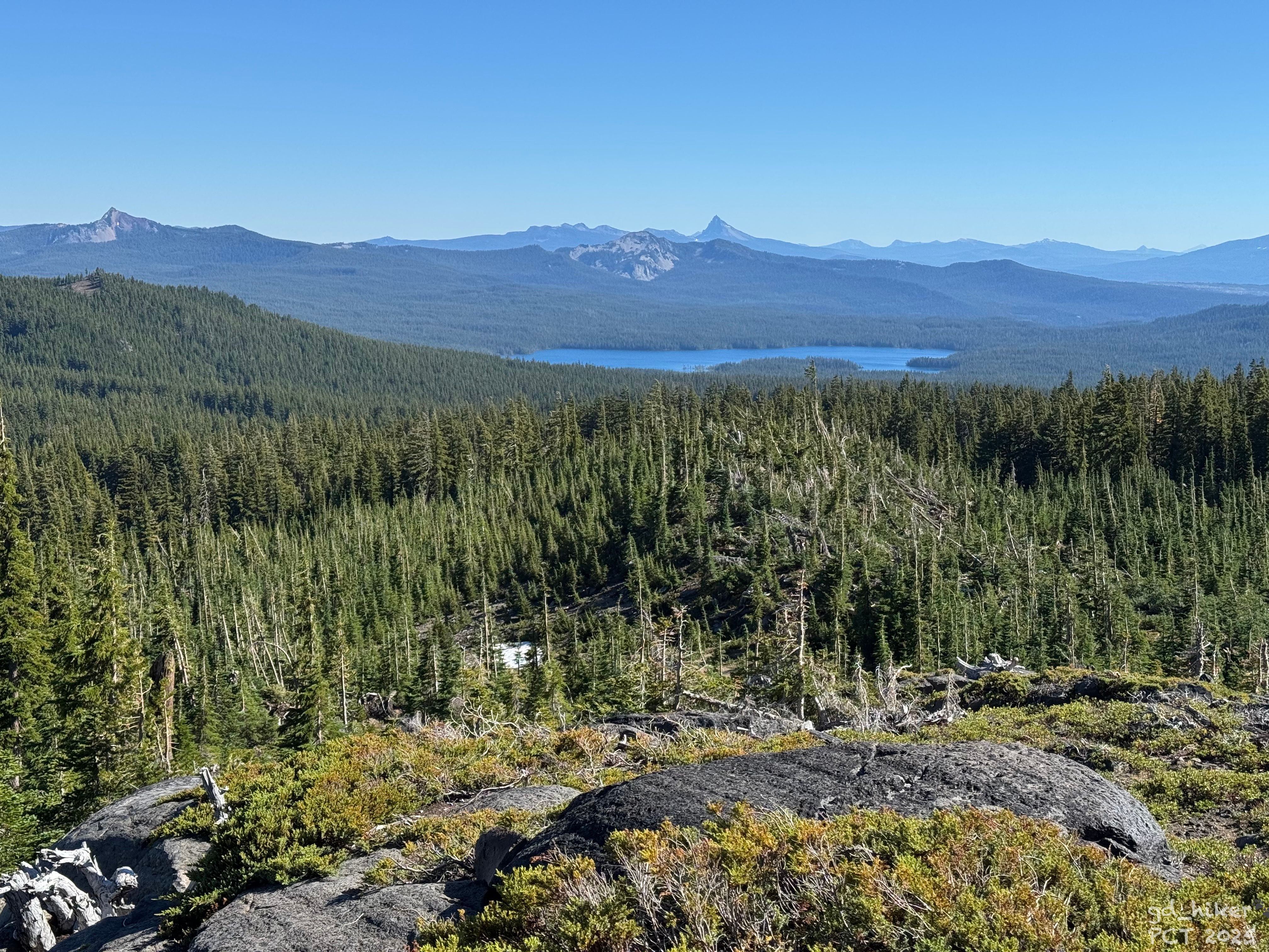
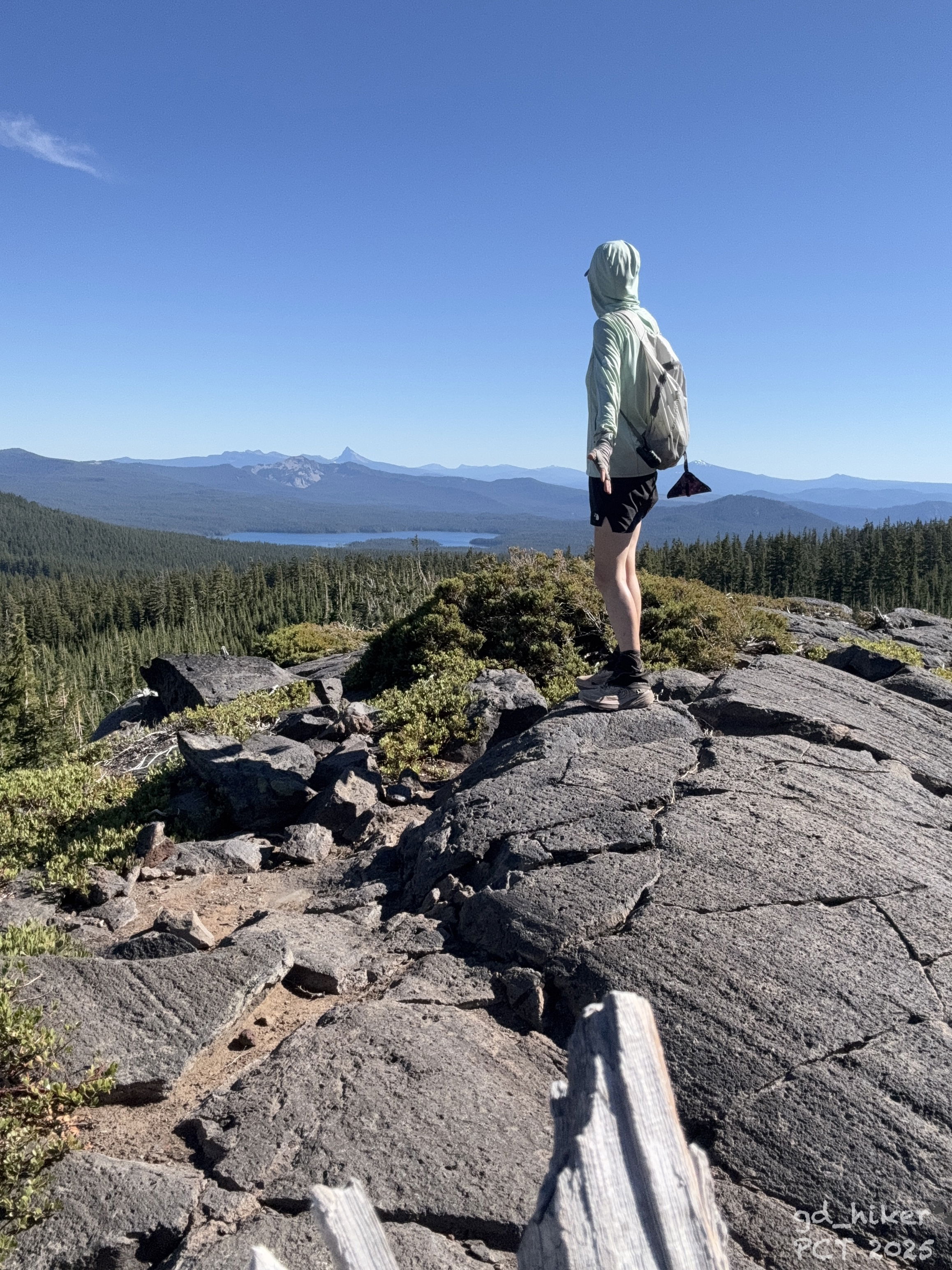
Um 16:30 Uhr erreichte ich nach 8,7 km mein heutiges Tagesziel – mit Blick auf den Diamond Peak und in die Weite.
Der Apfel war schnell verspeist, sodass ich mich bereits nach 20 Minuten wieder auf den Rückweg machte.
Es war ein herrlicher Tag, und mir wurde bewusst, wie sehr ich den Trail vermisst hatte.
Der blaue Himmel, die Sonne und dieses einfache Sein in der Natur 💚
Um 18:30 Uhr kehrte ich zu meinem Zelt zurück und stellte fest: Auch ein weiterer Hiker hatte hier für die Nacht sein Lager aufgeschlagen.
Ein NOBO-Hiker saß am Tisch, als ich ihn begrüßte. Und, was ich nie vermutet hätte, er war Däne 🇩🇰
Zunächst war ich nicht begeistert, dass sein Zelt so nah neben meinem stand.
Doch der Abend entwickelte sich zu einem sehr angenehmen – wir aßen gemeinsam und unterhielten uns lange.
Er wirkte etwas frustriert, was er auch nicht abstritt. Er erzählte von einer Section, die aufgrund der dichten Vegetation kaum zu durchqueren gewesen sei. Ich musste schmunzeln und erwähnte die Section K nur am Rande.
Er war deutlich länger unterwegs als ich, da er an der mexikanischen Grenze gestartet war. Ankommen war inzwischen sein Hauptziel, aber auch die Bedeutung von Zeros hob er hervor.
Ich konnte ihn irgendwie jetzt schon sehr gut verstehen.
Nachdem ich meine Füße noch im See gewaschen hatte, zog ich mich um 20:00 Uhr ins Zelt zurück.
In der Nacht war Vollmond, und er schien gefühlt besonders hell. Es wirkte fast, als wäre es taghell.
---------------------------------
Tageskilometer 17,55 km (Slackpack)
Gesamtkilometer 1273,71 km
---------------------------------
Englisch Version:
What a way to start the day.
The fire was still burning along the highway, and the road toward Willamette Pass remained closed. I stayed in contact with Anna, who couldn’t make it to work but said they would continue to monitor the situation and could react spontaneously if needed.
She kindly offered me another night in the house – free of charge. I was incredibly grateful for her generosity.
And yet, I was also a bit frustrated. Still, I chose to see it as a sign that I needed more rest. My feet weren’t fully healed yet, but with water soaks, ointment, and antibiotics, they were already improving.
I went grocery shopping, knowing I would likely have to stay another night – when Kevin, another co-host, reached out.
He was heading to Summit Lake, which lies along the PCT about 25 km south of Willamette Pass, and offered to take me with him at 1 p.m. He knew a way around the closure, and the forest roads further south were apparently open.
The trail provides.
Without overthinking, I agreed and quickly packed my gear again.
Kevin arrived on time, and we set off right away. His fluffy companion came along as well – unfortunately, I can’t remember the dog’s name.
During the drive, Kevin shared stories about the area, where he had worked and hiked before. I was just happy to be heading back to the trail.
Around 2:15 p.m., Kevin – a true trail angel in my eyes – dropped me off at Summit Lake. After a heartfelt thank you, we said our goodbyes.
A short time later, my tent was pitched at a beautiful lakeside spot, with a table adding a touch of comfort.
I packed some water and an apple into my daypack and set off to find the PCT northbound trailhead.
Soon I found the trail, and off I went. Hiking with a light pack felt unusual but refreshing as I made my way uphill toward a viewpoint overlooking Diamond Peak.
Along the gentle climb, I passed several lakes, buzzing with mosquitoes – stopping was definitely not an option.
I scrambled across another field of fallen trees and avalanche debris, smiling at how short this "Section K" stretch felt in comparison.
By 4:30 p.m., I reached my goal for the day – 8.7 km of slackpacking – rewarded with a stunning view of Diamond Peak and the vast landscape beyond.
The apple was gone within minutes, and after just 20 minutes, I was already on my way back.
It was a beautiful day, and I realized how much I had missed being out here. The blue sky, the sun, and the simple act of being in nature 💚
At 6:30 p.m., I returned to my tent and noticed another hiker had set up nearby for the night. A NOBO hiker was already sitting at the table when I arrived.
At first, I wasn’t thrilled about how close his tent was pitched, but the evening turned out to be very pleasant. We shared dinner and talked for quite a while.
He seemed a bit frustrated, something he didn’t deny. He spoke about a section of the trail that was extremely overgrown and difficult to pass. I couldn’t help but smile and only briefly mentioned Section K in response.
He had been on the trail much longer than I had, starting at the Mexican border. Reaching the finish had become his main goal, though he also emphasized the importance of zeros.
I could already relate to him.
After washing my feet in the lake, I crawled into my tent at around 8 p.m.
That night, the full moon shone so brightly it almost felt like daylight.
Daily distance: 17.55 km (Slackpack)
Total distance: 1,273.71 km